NavigoX is an ActiveX control offering map features that can be easily integrated with an own application. The product can be embedded in apps developed in environments that support the ActiveX technology.
The product can be embedded in apps developed in environments that support the ActiveX technology such as Visual Basic, Visual C, Borland C , Borland Delphi, MSAccess, Visual C# and others.
- it meets the actual needs of software developers,
- it offers the required features in a non-nonsense and efficient manner that is optimal from the viewpoint of commercial IT project development,
- the scope of offered features covers the vast majority of typical applications,
it separates specialised features used for specific applications into specialised modules dedicated to such features, - wydziela specjalistyczne, wykorzystywane do konkretnych zastosowań funkcje, do dedykowanych dla tego typu zastosowań specjalistycznych modułach,
- it provides the right tools for the right job: simple tools for typical functions and sophisticated tools for specialist applications.
NAVIGO X key features
NavigoX enables the conversion of the visible map into a Windows bitmap and printout, saving to a file or copying to clipboard.
System events
Thanks to support for system events such as mouse clicks or events caused by map operations, the standard map features can be extended to include specific user features.
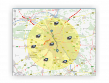
NavigoX features an advanced and very efficient object search module. It allows searches for administrative units, towns, streets, addresses and POIs with the use of various criteria.
A route generated by the control can be exported to the Navigo app, to be used in navigation.
The control allows readings of the current GPS position and its display on the map. In addition, the GPS position can be used to calculate and track a route.
The geocoding module allows basic geocoding of the user objects’ positions for the purpose of their presentation on the map.
The control allows the use of external sources from data bases with an SQL interface. The data is integrated with the main data base and displayed through the map kernel mechanisms.
NavigoX is a technology constantly expanded to meet the clients’ needs. New modules are being developed for specific applications in line with market demands.