Free access map generator

Welcome to the access map generator website! Now it takes only a couple minutes to generate a functional access map for your location that you can easily integrate with your website. Adjust the colour scheme and features of your access map for up to 10 locations. Feel free to generate your own access map!

How to generate an access map for your location?

  1. Fill out the form “Listing position & content”, then choose SAVE to save the address for which you want to generate a listing.
  2. Adjust extra settings in the “Listing look” form. With the use of the “Picture” option, you can upload your own logo to be displayed on the listing.
  3. Selected a “Map look” of your choice to match your website.
  4. Use “Refresh preview” to see your listing (in the preview, the map always features a constant width and height, the listing for your website will be generated in accordance with the size settings in the “Map look” form).
  5. Once you have set up all the settings for your listing, press the “Generate CODE” button – you will be asked to enter the address of the website on which the minimap is to be embedded and a contact email. Then, you will receive an email with the HTML code for your listing and instructions to embed it in your website.

Continue reading

Minimap generator

The minimap generator allows easy and quick generation of minimaps for the client’s website that show the selected location of the given event of object. The client themselves chooses the look, scale and size of the minimap. Continue reading

Navigo Navigation

Tourism content: Mapa A map of Poland featuring tourism content from Copernicus tourist guides. The app features extra information such as mountain contour lines or bathymetry data for Masurian lakes. In other words, you just need to take out a nav device and start your trek along a tourist route.

Road guides: In-depth and latest information on restaurants, accommodation and tourist attractions: opening hours, accepted payment forms, sample prices, parking availability and many other information!

Tourist trips: Pre-made tourist trips – having a good time without getting lost. Wondering how to spend the next extended weekend? Navigo offers ready solutions for your nav device.

Door-to-door navigation: Real-world address locations for accurate door-to-door navigation. We do not interpolate street addresses – each address is the centre of the relevant building. Voice commands, graphic commands, 2D/3D map and a navigation panel with all the information needed to reach the destination.

Features

Navigation

Navigation to the selected destination: pedestrian route, car route, quickest or closest route
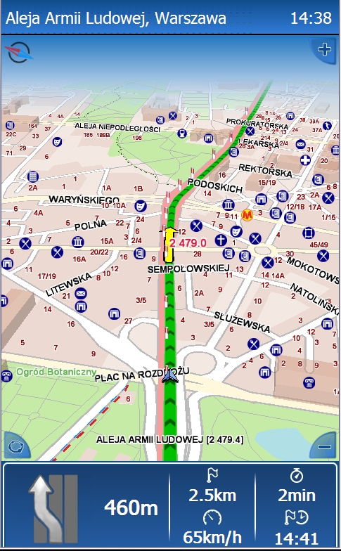
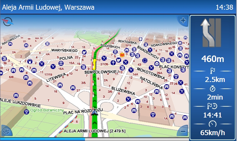
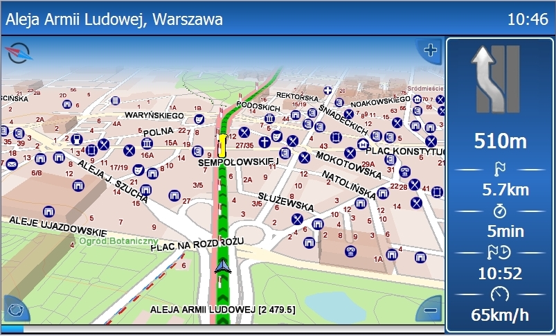
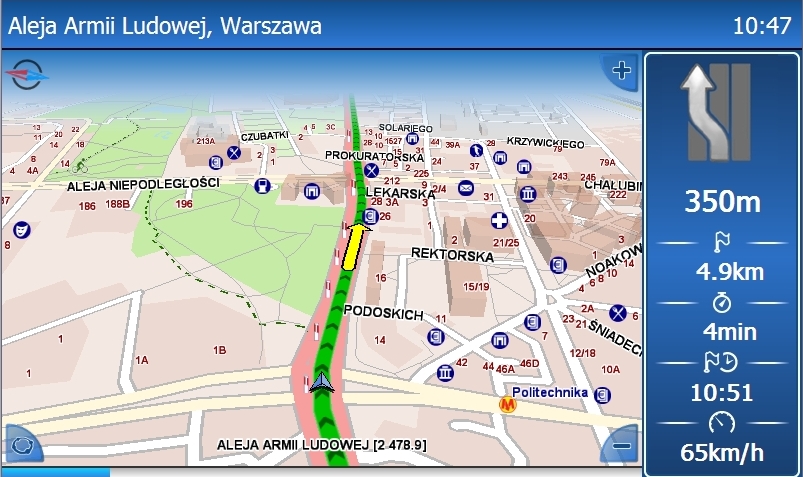
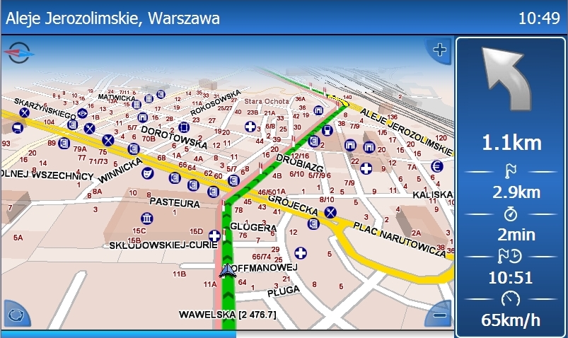
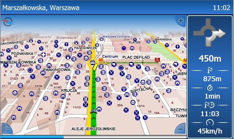
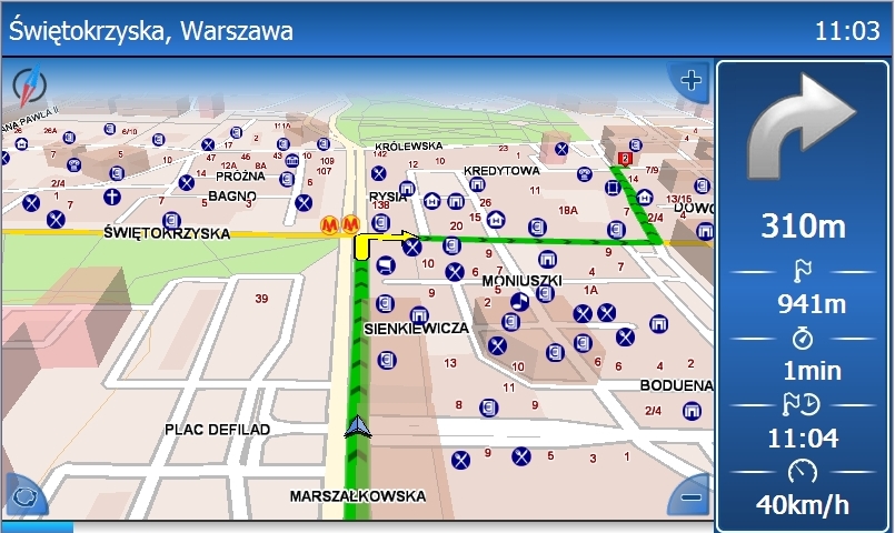
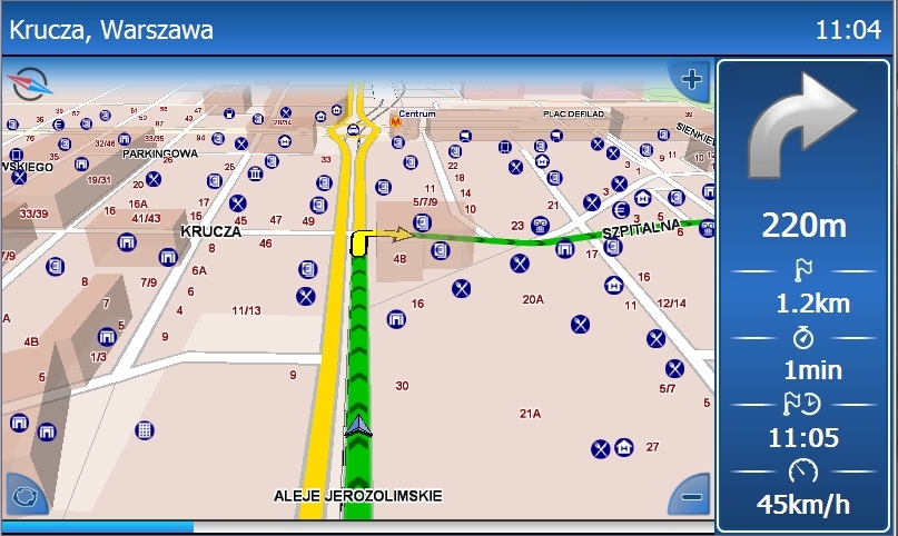
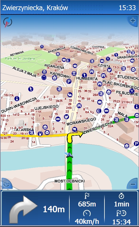
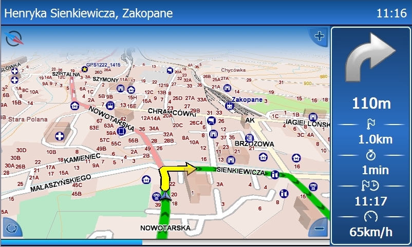
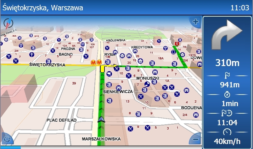
Navigation to predefined home or work location, to the selected address, to last selected address, map point, user’s location, PoI, intersection, nearby object. Pedestrian, closest or fastest route. Navigate to your home in two screen touches: NAVIGATE ->HOME. When navigating, the map scale is adjusted to the vehicle speed: a large and detailed scale at low speeds and a general view at high. When you leave the selected route, a new route is recalculated.
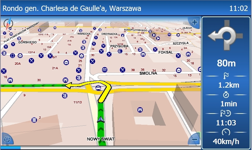
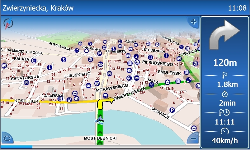
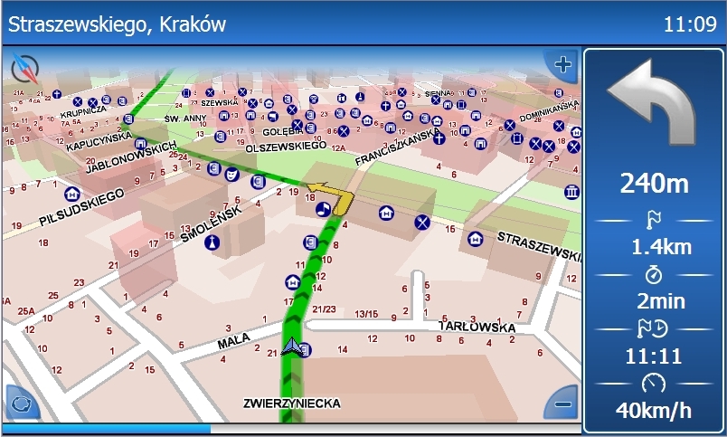
Voice messages and visual messages directly on the map and on the panel below the map.
Navigate with the help of male or female voice messages. The possibility to use own voice messages and play with the nav device. The software also features visual cues for the incoming manoeuvres on the map and in the navigation panel next to the map. Navigate in one of three display modes: full-screen map only, map plus navigation panel or full-screen cues without map.
Detailed information on travel facilities: accommodation, restaurants and tourist attractions
Hungry? Looking for interesting places along the route? Late and looking for a place to sleep? Instead of browsing the Internet, you can find in-depth information in NAVIGO guides. Cuisine types, accepted payment forms, sample menu prices, number of rooms and parking availability – you can find all such information during navigation.

Positioning

Locate your current GPS position
You can track your GPS position without specifying a route. In the positioning mode, the map rotates along with the vehicle’s direction and pans so that the vehicle’s location is always visible on the map: as an arrow when moving or as a dot and a circle when stationary.
Possibility to save and restore a GPS route
Want to save your route? Did you find a cool route and want to share it with your friends? Navigo lets you save and restore a GPS route. If you enter a destination compatible with a stored route when replaying a file, you will get a travel simulation along with voice and visual messages.

Route planning

Route planning with mid-route locations
You can plan a route with up to 15 mid-route locations. You do not have to enter the start point as your GPS position is added automatically as the start. The voice message “You have arrived at a mid-route location" will tell you that you have arrived at each location.
Saving routes
You can save and restore routes, change the order of route locations and see them on the map. You can also review a route before you start your journey.
Searching for objects mid-route
When navigating a planned route, you can search for objects in a selected category or chain located ahead on your route. You can define the search distance from your route.Choose the ‘ATM’ category and the name of the ATM chain if you seek a no-commission ATM along the route.
Pre-made trips
Each trip features a dozen or so tourist attractions along a route and a direction. NAVIGO will guide you through the locations and announce the arrival at each location with a voice message ‘Trip location’ and an appropriate visual message. Each location features a short description.

Other functions

Add user’s locations
You can add your own locations as Your Places in NAVIGO.
You can add locations to the following categories: Home, Work, My Places, Friends & Family, Work Contacts. You can set any of Your Places as a nav destination with two screen touches! You can also export and import Your Place categories to share Your Places with other NAVIGO users.
Save locations, report locations for update
In NAVIGO, you can save an interesting location that you have just passed by without leaving the navigation app. You can also report a map error by saving a location, providing a short description of the bug and sending us an exported category of Your Places – Map Error. You can have an impact on the accuracy of our maps. Report a location to update.
Large and easy to use touch buttons
The large and easy to use touch buttons enable true full-touch and stylus-free controls. An easy to use menu and ergonomic interface warrant efficient navigation.

Requirements

  • CPU 400Mhz
  • Operating system: Windows Mobile 6.0 or later compatible or Windows CE(4.2-6.0)
  • Available RAM: 30MB
  • Free disc space: 200 MB for PL map
  • GPS receiver
  • Internal GSM module

Where to buy?

You can buy Navigo through our online store.

Navigo X

NavigoX is an ActiveX control offering map features that can be easily integrated with an own application. The product can be embedded in apps developed in environments that support the ActiveX technology.

The product can be embedded in apps developed in environments that support the ActiveX technology such as Visual Basic, Visual C, Borland C , Borland Delphi, MSAccess, Visual C# and others.

The component has been developed with the use of the Navigo technology and features a common map drawing kernel and GIS features with Navigocommercial product lines.
Therefore:
  • it meets the actual needs of software developers,
  • it offers the required features in a non-nonsense and efficient manner that is optimal from the viewpoint of commercial IT project development,
  • the scope of offered features covers the vast majority of typical applications,
    it separates specialised features used for specific applications into specialised modules dedicated to such features,
  • wydziela specjalistyczne, wykorzystywane do konkretnych zastosowań funkcje, do dedykowanych dla tego typu zastosowań specjalistycznych modułach,
  • it provides the right tools for the right job: simple tools for typical functions and sophisticated tools for specialist applications.
The map features offered mean that NAVIGO X provides GIS features in addition to geographic data. The data is distributed in the PRDF format developed by Navigo.
NAVIGO X provides unlimited possibilities for the implementation of existing maps and NAVIGO features for independent developers of Windows-based solutions.

NAVIGO X key features

The control’s key feature is the presentation of a map in a visual form and allowing work through a user interface. The control features three work modes: pan mode, object selection and distance measurement, which allow basic operations.
The features are accessible with the use of a mouse and on the developer level with the use of appropriate methods.

NavigoX enables the conversion of the visible map into a Windows bitmap and printout, saving to a file or copying to clipboard.

System events

Thanks to support for system events such as mouse clicks or events caused by map operations, the standard map features can be extended to include specific user features.

Search features

NavigoX features an advanced and very efficient object search module. It allows searches for administrative units, towns, streets, addresses and POIs with the use of various criteria.

Routes
The route generation module allows the calculation of routes and road distances. The module allows the configuration of multiple parameters so that the routes meet the clients’ specific requirements.

A route generated by the control can be exported to the Navigo app, to be used in navigation.

GPS

The control allows readings of the current GPS position and its display on the map. In addition, the GPS position can be used to calculate and track a route.

Geocoding

The geocoding module allows basic geocoding of the user objects’ positions for the purpose of their presentation on the map.

Data sources
The main data source for the NavigoX is a PRDF database recorded in a proprietary format developed by Navigo.

The control allows the use of external sources from data bases with an SQL interface. The data is integrated with the main data base and displayed through the map kernel mechanisms.

Expansions

NavigoX is a technology constantly expanded to meet the clients’ needs. New modules are being developed for specific applications in line with market demands.

For further details of the offer, contact:
tel.:  +48 56 654 69 89